
The new standard for
field-grade drones.
The Nolvis M1 is an NDAA-compliant drone — incredibly stable in the air, one case on the ground, and three hot-swappable payloads for surveying, mapping, and inspection.
(90 min max)
Secure by design — a vetted, NDAA-compliant supply chain.
FCC certification applies to the Nolvis Pilot controller. NDAA eligibility may depend on payload configuration and the requirements of the purchasing agency.
Watch the M1 map a site — start to finish.
A drone company built for industry.
Nolvis exists to make professional drones something every field team can own — not just the largest operators. We design and support our own aircraft, and keep inventory, service, and live demos close to the teams that use them.
The name Nolvis unites the Latin novus — for new — with vis — force and power. Ride the next current of industry — and see what others can't.
Three reasons to choose the M1.
A professional aircraft without the procurement risk, the crew van, or the complexity.
Secure by design
Our own flight controller, our own ground station, and a vetted, NDAA-compliant supply chain. Built for procurement and data-security requirements.
One operator, one case
7.96 lbs with battery — roughly one-third the weight and folded volume of legacy heavy platforms, with 45 minutes of flight on a full payload.
Stable, bright, simple
Incredible stability in the air, a 1,000-nit sunlight-readable controller in your hands, and payload swaps in seconds — field-ready without an expert pilot.
* Size and weight compared with 9-kg-class legacy industrial platforms: approx. 1/3 folded transport volume (~35.6 L vs. ~115 L) and approx. 1/3 weight (3.61 kg vs. 9.7 kg class, with batteries). Based on publicly available manufacturer data as of 05/2026.
Nolvis M1 System.
Folded, it disappears into a single case. Unfolded, it flies longer than platforms twice its weight — on hardware that is ours from the flight controller up.
Our own — not a black box
Full control of the stack: faster fixes, tighter integration, behavior we can guarantee.
Integrate your own payload
A development kit for the quick-release mount lets you bring your own sensor — build, integrate, and customize on the M1 platform.
Engineered together
Airframe, battery, controller, and ground station designed as one system. Operates 14 °F to 122 °F.
One system,
from stick to cloud.
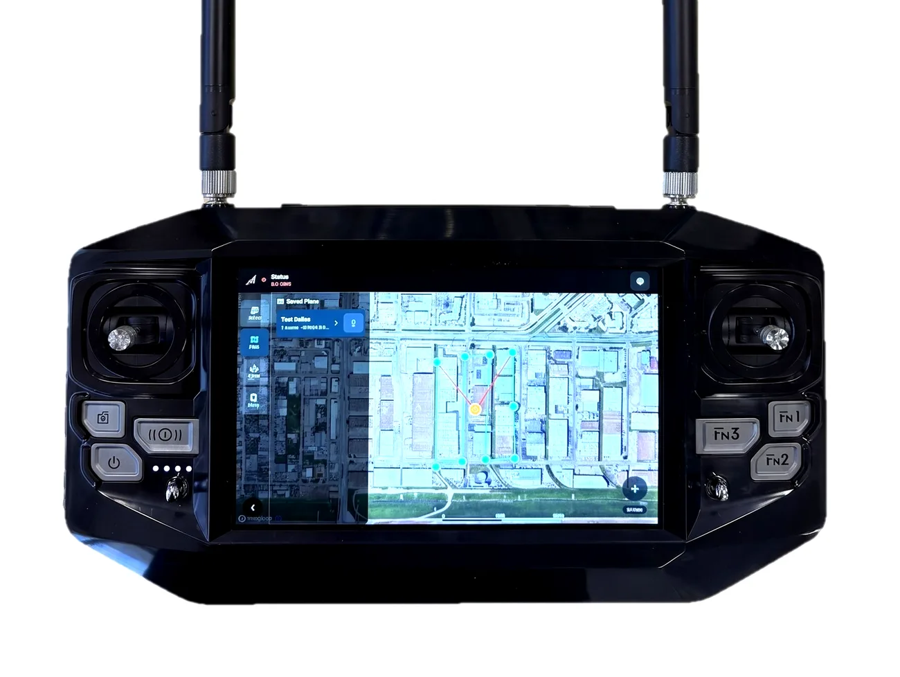
Nolvis Pilot is the controller in your hands; Nolvis Ops is the ground station in your browser. Both are ours — built for the M1.
Built-in NTRIP client
Connects directly to RTK correction networks — no external modules.
Centimeter-level, real time
Real-time kinematic positioning through your RTK correction service.
PPK ready
Post-processed kinematic workflow for absolute confidence in deliverables.
Corrections stay live
Built-in 4G/LTE keeps correction data updated in real time — FCC certified.
One aircraft. Every mission.
Hot-swap payloads in seconds on the M1's quick-release gimbal mount — no tools, no recalibration. Re-role the same aircraft from mapping at sunrise to powerline inspection by noon — or integrate your own sensor with the payload development kit.
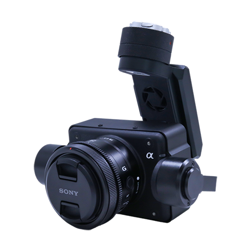
LR1 — Sony ILX-LR1
61 MP full-frame imaging for survey-grade photogrammetry.
| Sensor | 61.0 MP full-frame CMOS |
| Lenses | 24 / 40 / 50 mm (E-mount) |
| Weight | 1.57 lbs (710 g) |
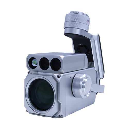
NV1 — Nolvis Vision 1
25× optical zoom, radiometric thermal, and a laser rangefinder — one hybrid module for inspection, security, and SAR.
| Zoom | 25× optical (STARVIS 2) |
| Thermal | 640×512 · −40 to 1022 °F (−40 to 550 °C) |
| Rangefinder | up to 2.2 mi (3.5 km) |
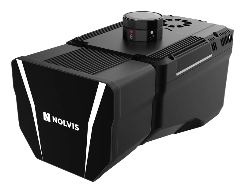
NL1 — Nolvis LiDAR 1
Survey-grade laser scanning with dual RGB cameras for dense, colorized point clouds.
| Accuracy | ±2.0 in (±5 cm) |
| Scan rate | 2,000,000 pts/s · 16 echoes |
| Weight | 4.08 lbs (1.85 kg) |
Built for the work that pays for it.
From topo survey to mine site
Topographic survey, stockpile volumes, and mine-site mapping with RTK/PPK georeferencing — LR1 for photogrammetry, NL1 for dense point clouds.
Lines, substations, towers
25× zoom for detail, thermal for hotspots, and a rangefinder for standoff distance.
Reduce shutdowns and scaffolding
Flare stacks, tanks, and pipelines inspected while the plant keeps running.
Aircraft
| Imperial | Metric | |
|---|---|---|
| Compliance | NDAA Compliant | |
| Hover time | 45 min @ 5.5 lbs payload 90 min max (no payload) | |
| Weight (incl. battery) | 7.96 lbs | 3.61 kg |
| Max payload | 5.5 lbs | 2.5 kg |
| Dimensions (unfolded) | 44.7 × 40.0 × 11.4 in | 1135 × 1015 × 290 mm |
| Dimensions (folded) | 16.2 × 10.8 × 12.4 in | 411.5 × 275 × 315 mm |
| Max transmission | 6.2 mi · 9.3 mi directional | 10 km · 15 km |
| RTK accuracy (H) | 0.04 in + 1 ppm | 1 cm + 1 ppm |
| PPK | Supported (via Nolvis Pilot) | |
| IP rating | IP44 | |
| Max wind resistance | 34 mph | 15 m/s |
| Operating temperature | 14 °F to 122 °F | −10 °C to 50 °C |
| Power | 6s 20 Ah semi-solid-state · 438 Wh | |
Nolvis Pilot — controller
| Screen | 7-inch 1080p · 1,000 nits |
| RTK / PPK | Built-in NTRIP client · PPK ready |
| Connectivity | 4G/LTE · FCC certified |
| Transmission | 6.2 mi (10 km) |
| Battery life | approx. 4.5 hours |
Payload modules
| LR1 — camera | 61 MP full-frame · 1.57 lbs |
| NV1 — zoom + thermal | 25× · 640×512 · LRF 2.2 mi |
| NL1 — LiDAR | ±2.0 in · 2M pts/s · 4.08 lbs |
| Mount | Quick-release gimbal · hot-swap |
The questions buyers ask first.
Is the Nolvis M1 NDAA compliant?
The M1 airframe and Nolvis Pilot controller are built on an NDAA-compliant, vetted supply chain — built for U.S. procurement and data-security requirements. Eligibility may depend on payload configuration and the requirements of the purchasing agency.
Does the M1 need an external RTK base station?
No. Nolvis Pilot has a built-in NTRIP client with 4G/LTE — connect your RTK correction service for centimeter-level positioning, with no external base station or add-on modules. PPK workflows are also supported.
How fast can I swap payloads?
Seconds. The quick-release gimbal mount hot-swaps the LR1, NV1, and NL1 modules without tools or recalibration.
How does the M1 compare to heavy industrial platforms?
Roughly one-third the weight and folded volume of 9-kg-class legacy platforms — one operator and one case instead of a vehicle and a crew.
Apply for a demo session.
We run live, hands-on demonstrations of the Nolvis M1. Tell us about your operation and a specialist will reach out within three business days.